Digital heritage preservation
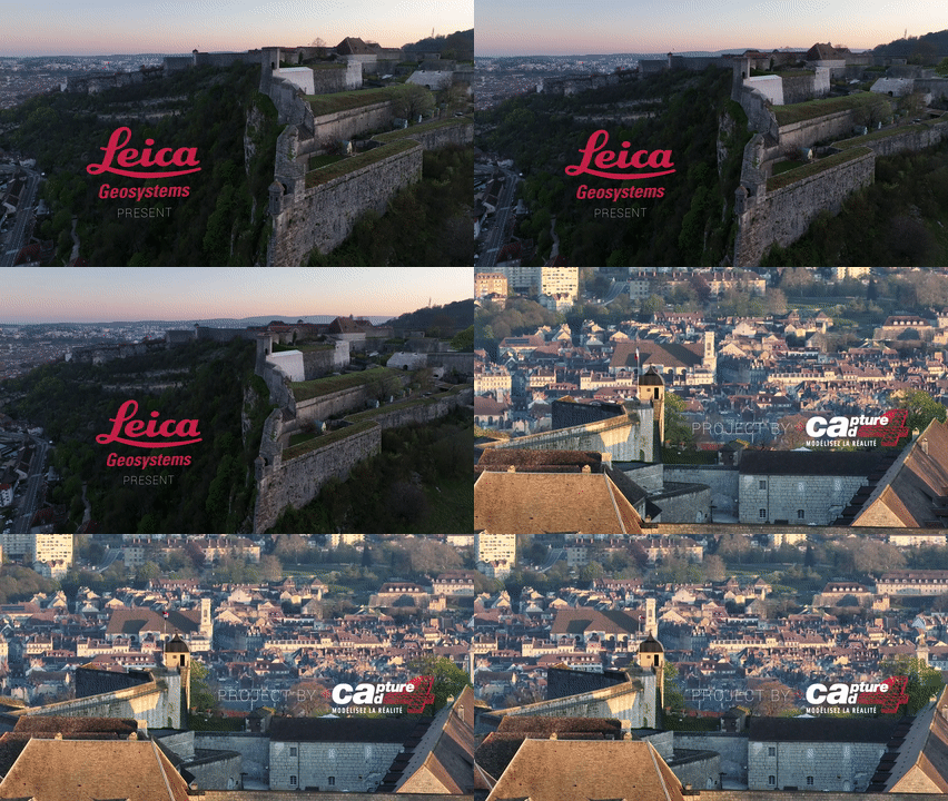
Rising high above the city of Besançon in eastern France, the 17th-century Citadelle de Besançon stands with its weathered walls harbouring over 400 years of rich history. Built by military architect Sébastien Le Prestre de Vauban, the Citadelle is perched atop Mount Saint-Étienne and sprawls over four hectares. This UNESCO World Heritage Site has endured wars, sieges, and the ravages of time. Today, it houses four museums, including a zoological park.
An innovative project between the French Government and Capture4Cad is underway, using cutting-edge reality capture technology from Leica Geosystems to bring the Citadelle to life while preserving its legacy for future generations. Hugo Parent, Head of the Heritage Department at Capture4Cad, is an expert in this area, having previously scanned specific sections of the Citadelle. He undertook this commission from the French Minister of Culture, calling for a 3D model of the whole Citadelle to be created. The project aims to create an augmented reality version of the 17th-century Citadelle for visitors to experience, while also using the data to preserve the UNESCO World Heritage site.
The challenges of scanning 17th-century history
Not only was this a mammoth challenge due site’s size, but the site’s complexity meant that precise scanning needed to be carried out from the air, on the ground and even through tunnels and down a 128-metre well. Large parts of the Citadelle are inaccessible, impacting the preservation of the already crumbling site, and cliffs and high walls make the rampart unreachable. In addition, site scanning had to be done around visitor access hours and couldn’t disturb the animals from the zoo.
The scale of the project, ultimately creating a model of what the Citadelle looked like in the 17th century for visitors to experience, meant that all these challenges needed to be overcome to capture the whole site with a high level of accuracy.
“Without the technology from Leica Geosystems it would have been impossible for us to document this important site in such an impressive way,” said Hugo Parent, Head of the Heritage Department at Capture4Cad. “Autonomous laser scanning not only means that we will have been able to capture the Citadelle as it is now, but visitors can immerse themselves area’s history for years to come.” Hugo Parent, Head of the Heritage Department at Capture4Cad
Leica Geosystems' autonomous portfolio provides the perfect range of solutions
Capture4Cad was able to address the challenges head-on using reality capture laser scanners and software solutions from Leica Geosystems’ BLK Autonomy portfolio.
Click here to view the photograph flipbook that documents this remarkable journey in stunning pictures.
Easy reality capture from the sky
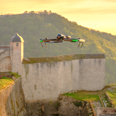
The Leica BLK2FLY autonomous flying scanner was used to capture intricate details of the Citadelle's ramparts, roofs and walls, and the inaccessible structures above ground to create the 3D point cloud. Using the BLK2FLY made it possible for Hugo to fly into and capture areas he couldn’t reach on foot, with its advanced obstacle avoidance feature ensuring no damage or disruption to the complex site. Its simple set-up and deployment enabled Hugo to make the most of scanning time whilst visitors were not onsite.
Image of the Leica BLK2FLY autonomous flying laser scanner capturing data over the Citadelle de Besançon.
Safely scan with a robotic carrier
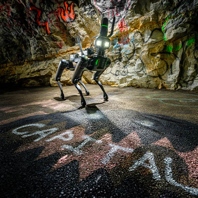
To scan deep within the well, Hugo deployed the mobile Leica BLK ARC which maintained a high level of precise scanning while being steadily lowered 128 metres into the ground. The BLK ARC was also mounted to Boston Dynamics autonomous robotic carrier to scan the grounds of the Citadelle. This was done with minimal human intervention, by setting a scanning path and letting the BLK ARC carry out the data capture to create a 3D point cloud.
Image of the Leica BLK ARC autonomous laser scanner for robotic and mobile carriers within a tunnel at the Citadelle de Besançon.
Data capture at your fingertips
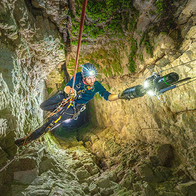
The handheld Leica BLK2GO was used to scan through the extensive tunnel system. The robot carrier was not permitted in this part of the Citadelle due to disrupting the animals living onsite, so the range of Leica Geosystems BLK solutions was essential to completing the model. Using the BLK2GO meant no time was lost, with continuous scanning taking place as it was carried through the tunnel rather than individual scans needing to be set up. SLAM technology records the user’s trajectory through space to capture images and dimensionally accurate point clouds in real-time with no interruptions.
Image of the Leica BLK2GO handheld imaging laser scanner being lowered into a deep well at the Citadelle de Besançon.
Integrated software workflows
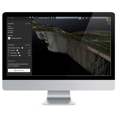
By using the Leica BLK scanning solutions, all captured data could be seamlessly uploaded directly into HxDR cloud platform and the industry-leading Cyclone point cloud processing software, Leica REGISTER 360 PLUS and Leica Cyclone 3DR, for further processing. Further software from the Hexagon family, Immersal SDK, will be used to build the augmented reality model. Capture4Cad specifically chose Leica Geosystems for this project because the entire workflow can be effortlessly carried out using its range of solutions and integrated software.
Image of Hexagon's Digital Reality solution, HxDR, for point cloud visualisation and collaboration.


